
Bansko topographic map
Click on the map to display elevation.
Bansko
Bansko (Bulgarian: Банско [ˈbansko]) is a town in southwestern Bulgaria, located at the foot of the Pirin Mountains at an elevation of 1200m above sea level. It is a ski resort.
About this map
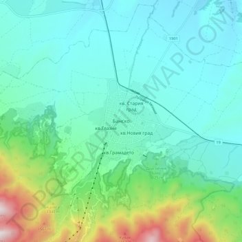
Name: Bansko topographic map, elevation, terrain.
Location: Bansko, Blagoevgrad, 2770, Bulgaria (41.79441 23.44417 41.87441 23.52417)
Average elevation: 3,392 ft
Minimum elevation: 2,628 ft
Maximum elevation: 6,293 ft
Other topographic maps
Click on a map to view its topography, its elevation and its terrain.