
Edison Township topographic map
Click on the map to display elevation.
About this map
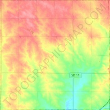
Name: Edison Township topographic map, elevation, terrain.
Average elevation: 1,506 ft
Minimum elevation: 1,358 ft
Maximum elevation: 1,624 ft
Minnehaha County trails, hiking, mountain biking, running and outdoor activities
Other topographic maps
Click on a map to view its topography, its elevation and its terrain.
Kirby Dog Park at Fort Sod
United States > South Dakota > Minnehaha County > Sioux Falls
Average elevation: 1,447 ft