Geolocate

Balabag topographic map

Click on the map to display elevation.

About this map

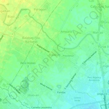
Name: Balabag topographic map, elevation, terrain.

Location: Balabag, Pavia, Iloilo, Western Visayas, 5001, Philippines (10.74730 122.49989 10.78730 122.53989)

Average elevation: 59 ft

Minimum elevation: 30 ft

Maximum elevation: 95 ft

Other topographic maps

Click on a map to view its topography, its elevation and its terrain.

Aganan River

Philippines > Iloilo > Pavia > Purok IV

Average elevation: 52 ft

Plaza Pavia

Philippines > Iloilo > Pavia > Purok III

Average elevation: 56 ft

Gear up for your next adventure:

🪑Ultralight Camp Chairs - Portable seating for resting after a long day of mapping
🥤Water Filter Bottle - All‑in‑one filter bottle for safe hydration
🦺Reflective Outdoor Gear - Safety gear for low‑light conditions
🪶Camping Sleeping Pad - Comfortable sleeping pad for backpacking
🧦Hiking Socks - Comfortable socks to prevent blisters on long hikes

As an Amazon Associate, this site earns from qualifying purchases at no extra cost to you.