
Make a donation
Gear up for your next adventure:
As an Amazon Associate, this site earns from qualifying purchases at no extra cost to you.
Oberhausen-Rheinhausen topographic map
Click on the map to display elevation.
Make a donation
Gear up for your next adventure:
As an Amazon Associate, this site earns from qualifying purchases at no extra cost to you.
Oberhausen-Rheinhausen
Der Gemeinderat hat normalerweise 22 ehrenamtliche Mitglieder, die für fünf Jahre gewählt werden. Die Zahl der Mitglieder kann sich durch Ausgleichssitze erhöhen (gesamt 2019: 24 Sitze; 2014: 22). Hinzu kommt der Bürgermeister als stimmberechtigter Gemeinderatsvorsitzender.
Make a donation
Gear up for your next adventure:
As an Amazon Associate, this site earns from qualifying purchases at no extra cost to you.
About this map
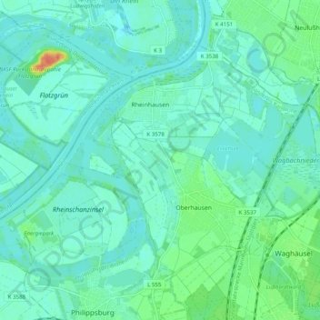
Name: Oberhausen-Rheinhausen topographic map, elevation, terrain.
Average elevation: 325 ft
Minimum elevation: 295 ft
Maximum elevation: 440 ft
Make a donation
Gear up for your next adventure:
As an Amazon Associate, this site earns from qualifying purchases at no extra cost to you.
Other topographic maps
Click on a map to view its topography, its elevation and its terrain.
Östringen
Deutschland > Baden-Württemberg > Landkreis Karlsruhe > Östringen > Östringen
Average elevation: 581 ft
Justizvollzugsanstalt Bruchsal - Außenstelle Kislau
Deutschland > Baden-Württemberg > Landkreis Karlsruhe > Bad Schönborn
Average elevation: 381 ft
Make a donation
Gear up for your next adventure:
As an Amazon Associate, this site earns from qualifying purchases at no extra cost to you.