Geolocate

Windlesham topographic map

Click on the map to display elevation.

About this map

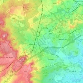
Name: Windlesham topographic map, elevation, terrain.

Location: Windlesham, Bagshot, Surrey Heath, Surrey, England, United Kingdom (51.33902 -0.73528 51.38737 -0.63205)

Average elevation: 253 ft

Minimum elevation: 105 ft

Maximum elevation: 436 ft

Other topographic maps

Click on a map to view its topography, its elevation and its terrain.

Gear up for your next adventure:

🧷Carabiner Set - Durable clips for gear attachment
🎁Geography Themed Gifts - Unique gift ideas for map lovers and geography enthusiasts
🪓Survival Multi‑Tool - Versatile tool for camp and trail tasks
🧣Hiking Neck Gaiter - Multi‑use neck protection for outdoor weather
🔥Plasma Lighters - Windproof lighters that work in any weather condition

As an Amazon Associate, this site earns from qualifying purchases at no extra cost to you.