Geolocate

Xuzhou topographic map

Click on the map to display elevation.

About this map

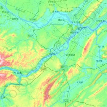
Name: Xuzhou topographic map, elevation, terrain.

Location: Xuzhou, Xuzhou District, Yibin City, Sichuan, China (28.53343 104.37062 28.85343 104.69062)

Average elevation: 1,398 ft

Minimum elevation: 820 ft

Maximum elevation: 3,304 ft

Gear up for your next adventure:

🌲Outdoor Survival Books - Best books on survival skills
📶Vehicle Signal Boosters - Improve reception in rural areas while driving to trailheads
🗺️NatGeo Topo Maps - High-quality waterproof printed topographic maps of US Parks
🔥Camping Stove - Portable stove for camping and backcountry cooking
🔋Solar Power Banks - Keep your GPS and phone charged in remote wilderness areas

As an Amazon Associate, this site earns from qualifying purchases at no extra cost to you.