
Thank you for supporting this site ❤️
Make a donation
Make a donation
Gear up for your next adventure:
As an Amazon Associate, this site earns from qualifying purchases at no extra cost to you.
Dapoli topographic map
Click on the map to display elevation.
Thank you for supporting this site ❤️
Make a donation
Make a donation
Gear up for your next adventure:
As an Amazon Associate, this site earns from qualifying purchases at no extra cost to you.
About this map
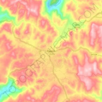
Name: Dapoli topographic map, elevation, terrain.
Location: Dapoli, Dapoli Taluka, Ratnagiri, Maharashtra, 415712, India (17.71805 73.14871 17.79805 73.22871)
Average elevation: 591 ft
Minimum elevation: 20 ft
Maximum elevation: 919 ft
Thank you for supporting this site ❤️
Make a donation
Make a donation
Gear up for your next adventure:
As an Amazon Associate, this site earns from qualifying purchases at no extra cost to you.