
Erie topographic map
Click on the map to display elevation.
About this map
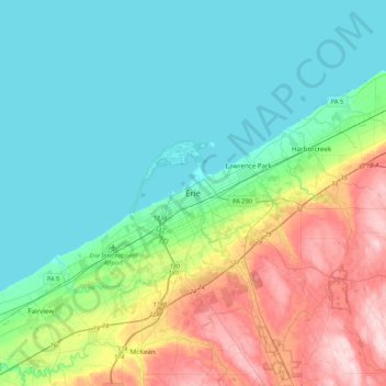
Name: Erie topographic map, elevation, terrain.
Location: Erie, Erie County, Pennsylvania, 16530, United States (41.96947 -80.24527 42.28947 -79.92527)
Average elevation: 833 ft
Minimum elevation: 554 ft
Maximum elevation: 1,614 ft
Erie County trails, hiking, mountain biking, running and outdoor activities