Geolocate

Longjie topographic map

Click on the map to display elevation.

About this map

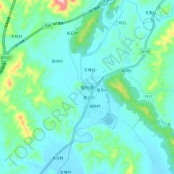
Name: Longjie topographic map, elevation, terrain.

Location: Longjie, Heyuan, Guangdong Province, China (24.15504 114.32055 24.23504 114.40055)

Average elevation: 607 ft

Minimum elevation: 394 ft

Maximum elevation: 1,647 ft

Gear up for your next adventure:

🧺Microfiber Travel Towels - Compact and fast-drying towels for trail use
🦟Ultrasonic Repellers - Create a bug-free zone at your camp or rest stop
🌡️Handheld Weather Meters - Measure wind, temp, and pressure for safe mountain travel
🧼Biodegradable Camping Soap - Eco‑friendly soap for outdoor hygiene
🛶Inflatable Kayak - Portable kayak for rivers, lakes, and expeditions

As an Amazon Associate, this site earns from qualifying purchases at no extra cost to you.