
Make a donation
Gear up for your next adventure:
As an Amazon Associate, this site earns from qualifying purchases at no extra cost to you.
Wangam topographic map
Click on the map to display elevation.
Make a donation
Gear up for your next adventure:
As an Amazon Associate, this site earns from qualifying purchases at no extra cost to you.
About this map
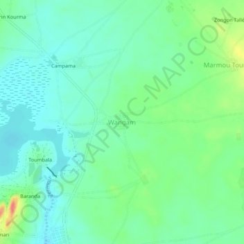
Name: Wangam topographic map, elevation, terrain.
Location: Wangam, Mirriah, Zinder Region, Niger (13.88660 9.31094 13.92660 9.35094)
Average elevation: 1,437 ft
Minimum elevation: 1,378 ft
Maximum elevation: 1,581 ft
Make a donation
Gear up for your next adventure:
As an Amazon Associate, this site earns from qualifying purchases at no extra cost to you.
Other topographic maps
Click on a map to view its topography, its elevation and its terrain.
Mirriah
Mirriah is located in the Sahel region, around 20 kilometres from the regional capital of Zinder. Mirriah's neighbouring municipalities are Gaffati to the north-west, Zermou to the north-east, Hamdara to the east, Wacha to the south-east, Gouna to the south-west and Kolléram to the west. The municipality lies…
Average elevation: 1,339 ft