Geolocate

Grebenstein topographic map

Click on the map to display elevation.

About this map

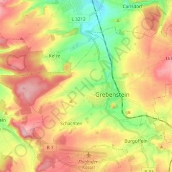
Name: Grebenstein topographic map, elevation, terrain.

Location: Grebenstein, Landkreis Kassel, Hesse, 34393, Germany (51.42303 9.33042 51.47965 9.45910)

Average elevation: 745 ft

Minimum elevation: 489 ft

Maximum elevation: 991 ft

Gear up for your next adventure:

👖Convertible Hiking Pants - Versatile zip-off pants for changing altitudes and temperatures
👟Men's Trail Runners - Lightweight footwear for fast-paced exploration and light hiking
🦺Reflective Outdoor Gear - Safety gear for low‑light conditions
🛡️Bear Spray Outdoor - Protection in bear country hikes
🛌Ultralight Sleeping Bags - Compact down bags for cold nights in the wilderness

As an Amazon Associate, this site earns from qualifying purchases at no extra cost to you.