Geolocate

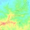
Sulucan topographic map

Click on the map to display elevation.

About this map

Name: Sulucan topographic map, elevation, terrain.

Location: Sulucan, Angat, Bulacan, Central Luzon, 3012, Philippines (14.92188 120.98194 14.96188 121.02194)

Average elevation: 112 ft

Minimum elevation: 56 ft

Maximum elevation: 243 ft

Other topographic maps

Click on a map to view its topography, its elevation and its terrain.
Encanto

Philippines > Bulacan > Angat

Average elevation: 190 ft

Gear up for your next adventure:

👟Trail Running Shoes - Lightweight shoes for trail runners
📱Heavy-Duty Phone Cases - Drop-proof and waterproof protection for outdoor navigation
⌚GPS Sports Watch - GPS watch for running, hiking and training
🚪Portable Camp Chair - Foldable chair for comfort at camp
🌡️Portable Weather Meter - Track weather conditions on the trail

As an Amazon Associate, this site earns from qualifying purchases at no extra cost to you.