
Make a donation
Gear up for your next adventure:
As an Amazon Associate, this site earns from qualifying purchases at no extra cost to you.
Beizama topographic map
Click on the map to display elevation.
Make a donation
Gear up for your next adventure:
As an Amazon Associate, this site earns from qualifying purchases at no extra cost to you.
Beizama
La ville de Beizama se situe dans les flancs du mont Illaun sur le massif de Murumendi. Elle est entourée de forêts et de prairies. Étant à 485 m d'altitude, elle est la seconde ville la plus haute du Guipuscoa après Bidania-Goiatz.
Make a donation
Gear up for your next adventure:
As an Amazon Associate, this site earns from qualifying purchases at no extra cost to you.
About this map
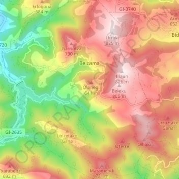
Name: Beizama topographic map, elevation, terrain.
Average elevation: 1,640 ft
Minimum elevation: 433 ft
Maximum elevation: 2,680 ft
Make a donation
Gear up for your next adventure:
As an Amazon Associate, this site earns from qualifying purchases at no extra cost to you.