
Make a donation
Gear up for your next adventure:
As an Amazon Associate, this site earns from qualifying purchases at no extra cost to you.
Berneau topographic map
Click on the map to display elevation.
Make a donation
Gear up for your next adventure:
As an Amazon Associate, this site earns from qualifying purchases at no extra cost to you.
Berneau
Berneau ligt in het weidegebied van het Land van Herve op een hoogte van ongeveer 75 meter. Door Berneau stroomt de Berwijn in noordelijke richting.
Make a donation
Gear up for your next adventure:
As an Amazon Associate, this site earns from qualifying purchases at no extra cost to you.
About this map
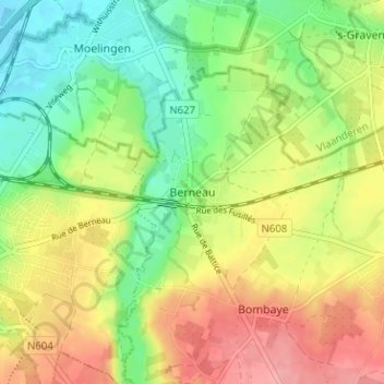
Name: Berneau topographic map, elevation, terrain.
Location: Berneau, Dalhem, Luik, Wallonië, 4607, België (50.72234 5.71125 50.76234 5.75125)
Average elevation: 322 ft
Minimum elevation: 180 ft
Maximum elevation: 486 ft
Make a donation
Gear up for your next adventure:
As an Amazon Associate, this site earns from qualifying purchases at no extra cost to you.