
Tetbury topographic map
Click on the map to display elevation.
About this map
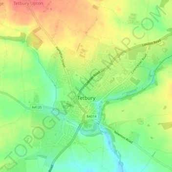
Name: Tetbury topographic map, elevation, terrain.
Average elevation: 400 ft
Minimum elevation: 299 ft
Maximum elevation: 512 ft
Other topographic maps
Click on a map to view its topography, its elevation and its terrain.
Aquaventure
United Kingdom > England > Gloucestershire > Cotswold District > Somerford Keynes > Shorncote
Average elevation: 302 ft
Broad Campden
United Kingdom > England > Gloucestershire > Cotswold District
Average elevation: 548 ft