Geolocate

Padiham topographic map

Click on the map to display elevation.

About this map

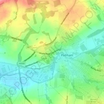
Name: Padiham topographic map, elevation, terrain.

Location: Padiham, Burnley, Lancashire, England, United Kingdom (53.78937 -2.34231 53.81291 -2.29589)

Average elevation: 341 ft

Minimum elevation: 220 ft

Maximum elevation: 528 ft

Gear up for your next adventure:

⛑️Personal Locator Beacon - Safety beacon for emergencies
🗺️Topographic Maps - Detailed topo maps for hiking, exploring and outdoor navigation
🎒Outdoor Daypacks - Lightweight backpacks designed for carrying maps and essential gear
🛰️Handheld GPS Units - Professional satellite navigators for precise backcountry mapping
🧣Merino Neck Gaiters - Multi-functional headwear for wind and sun protection

As an Amazon Associate, this site earns from qualifying purchases at no extra cost to you.