
Thank you for supporting this site ❤️
Make a donation
Make a donation
Gear up for your next adventure:
As an Amazon Associate, this site earns from qualifying purchases at no extra cost to you.
Paredes topographic map
Click on the map to display elevation.
Thank you for supporting this site ❤️
Make a donation
Make a donation
Gear up for your next adventure:
As an Amazon Associate, this site earns from qualifying purchases at no extra cost to you.
About this map
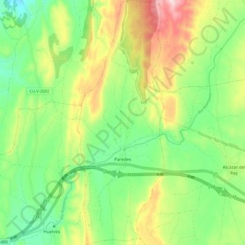
Name: Paredes topographic map, elevation, terrain.
Location: Paredes, Cuenca, Castile-La Mancha, Spain (40.03820 -2.87343 40.11732 -2.83686)
Average elevation: 2,881 ft
Minimum elevation: 2,457 ft
Maximum elevation: 3,566 ft
Thank you for supporting this site ❤️
Make a donation
Make a donation
Gear up for your next adventure:
As an Amazon Associate, this site earns from qualifying purchases at no extra cost to you.