
Thank you for supporting this site ❤️
Make a donation
Make a donation
Gear up for your next adventure:
As an Amazon Associate, this site earns from qualifying purchases at no extra cost to you.
M'zab topographic map
Click on the map to display elevation.
Thank you for supporting this site ❤️
Make a donation
Make a donation
Gear up for your next adventure:
As an Amazon Associate, this site earns from qualifying purchases at no extra cost to you.
About this map
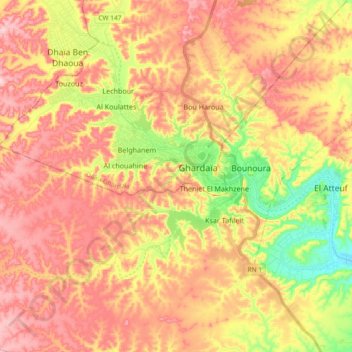
Name: M'zab topographic map, elevation, terrain.
Location: M'zab, Ghardaia, Ghardaia District, Ghardaia, Algeria (32.43453 3.57204 32.52948 3.75773)
Average elevation: 1,811 ft
Minimum elevation: 1,453 ft
Maximum elevation: 2,070 ft
Thank you for supporting this site ❤️
Make a donation
Make a donation
Gear up for your next adventure:
As an Amazon Associate, this site earns from qualifying purchases at no extra cost to you.