Geolocate

Tejas topographic map

Click on the map to display elevation.

About this map

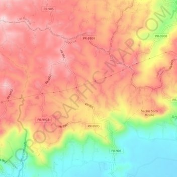
Name: Tejas topographic map, elevation, terrain.

Location: Tejas, Yabucoa, Puerto Rico, United States (18.09032 -65.91452 18.12612 -65.86560)

Average elevation: 617 ft

Minimum elevation: 39 ft

Maximum elevation: 1,017 ft

Yabucoa trails, hiking, mountain biking, running and outdoor activities

Gear up for your next adventure:

🪶Survival Guide Book - Expert advice for emergency preparedness
🌡️Handheld Weather Meters - Measure wind, temp, and pressure for safe mountain travel
🌐World Map Poster - Decorative world maps with topographic info
🕶️GPS Smartphone Mount - Secure mount for phone navigation
Camping Coffee Makers - Enjoy premium coffee at the summit or campsite

As an Amazon Associate, this site earns from qualifying purchases at no extra cost to you.