Geolocate

Breeding topographic map

Click on the map to display elevation.

About this map

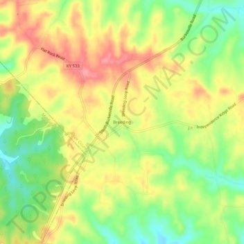
Name: Breeding topographic map, elevation, terrain.

Location: Breeding, Adair County, Kentucky, United States (36.93923 -85.45441 36.97923 -85.41441)

Average elevation: 991 ft

Minimum elevation: 840 ft

Maximum elevation: 1,132 ft

Adair County trails, hiking, mountain biking, running and outdoor activities

Gear up for your next adventure:

🗺️Topographic Maps - Detailed topo maps for hiking, exploring and outdoor navigation
🎒Gear Packing Cubes - Organize your backpack efficiently
🧭Compass with Lanyard - Easy‑carry compass for navigation
🛰️Handheld GPS Units - Professional satellite navigators for precise backcountry mapping
🪵Folding Camp Saw - Compact saw for wood and campsite work

As an Amazon Associate, this site earns from qualifying purchases at no extra cost to you.