
Thank you for supporting this site ❤️
Make a donation
Make a donation
Gear up for your next adventure:
As an Amazon Associate, this site earns from qualifying purchases at no extra cost to you.
Fariñentu topographic map
Click on the map to display elevation.
Thank you for supporting this site ❤️
Make a donation
Make a donation
Gear up for your next adventure:
As an Amazon Associate, this site earns from qualifying purchases at no extra cost to you.
About this map
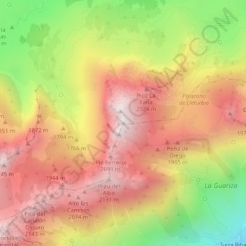
Name: Fariñentu topographic map, elevation, terrain.
Location: Fariñentu, Quirós, Asturies, 33628, Espagne (43.04085 -5.93562 43.04095 -5.93552)
Average elevation: 5,745 ft
Minimum elevation: 3,950 ft
Maximum elevation: 7,090 ft
Thank you for supporting this site ❤️
Make a donation
Make a donation
Gear up for your next adventure:
As an Amazon Associate, this site earns from qualifying purchases at no extra cost to you.