Geolocate

Salcedo topographic map

Click on the map to display elevation.

About this map

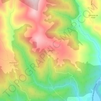
Name: Salcedo topographic map, elevation, terrain.

Location: Salcedo, Valderredible, Cantabria, 39220, Spain (42.80857 -3.97006 42.84857 -3.93006)

Average elevation: 2,913 ft

Minimum elevation: 2,270 ft

Maximum elevation: 3,556 ft

Gear up for your next adventure:

🪶Camp Gear Gift Set - Perfect gift bundle for outdoor fans
🛶Inflatable Kayak - Portable kayak for rivers, lakes, and expeditions
🖼️Topo Map Wall Art - Decorative topographic prints of famous peaks and regions
🗃️Trail First Aid Kit - Essential kit for outdoor injuries and emergencies
🪶Survival Guide Book - Expert advice for emergency preparedness

As an Amazon Associate, this site earns from qualifying purchases at no extra cost to you.