
Make a donation
Gear up for your next adventure:
As an Amazon Associate, this site earns from qualifying purchases at no extra cost to you.
Colby topographic map
Click on the map to display elevation.
Make a donation
Gear up for your next adventure:
As an Amazon Associate, this site earns from qualifying purchases at no extra cost to you.
Colby
Colby is located at 39°23′32″N 101°02′51″W / 39.392093°N 101.047532°W / 39.392093; -101.047532 (39.392093, -101.047532) at an elevation of 3,159 feet (963 m). It lies on the south side of Prairie Dog Creek, a tributary of the Republican River, in the High Plains region of the Great Plains. A small tributary of the creek flows northeast through the town. Located at the interchange of Interstate 70 and K-25 in northwestern Kansas, Colby is 212 mi (341 km) east-southeast of Denver, 232 mi (373 km) northwest of Wichita, and 347 mi (558 km) west of Kansas City.
Make a donation
Gear up for your next adventure:
As an Amazon Associate, this site earns from qualifying purchases at no extra cost to you.
About this map
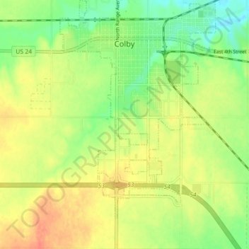
Name: Colby topographic map, elevation, terrain.
Location: Colby, Thomas County, Kansas, 67701, United States (39.35076 -101.07105 39.40552 -101.00097)
Average elevation: 3,182 ft
Minimum elevation: 3,104 ft
Maximum elevation: 3,255 ft
Thomas County trails, hiking, mountain biking, running and outdoor activities
Make a donation
Gear up for your next adventure:
As an Amazon Associate, this site earns from qualifying purchases at no extra cost to you.
Other topographic maps
Click on a map to view its topography, its elevation and its terrain.
Great Plains
United States > Kansas > Thomas County
The North American Environmental Atlas, produced by the Commission for Environmental Cooperation, a NAFTA agency composed of the geographical agencies of the Mexican, American, and Canadian governments, uses the "Great Plains" as an ecoregion synonymous with predominant prairies and grasslands rather than as…
Average elevation: 3,356 ft
Great Plains
United States > Kansas > Thomas County
The North American Environmental Atlas, produced by the Commission for Environmental Cooperation, a North American Free Trade Agreement (NAFTA) agency composed of the geographical agencies of the Mexican, American, and Canadian governments, uses the "Great Plains" as an ecoregion synonymous with predominant…
Average elevation: 3,356 ft
Great Plains
United States > Kansas > Thomas County
The North American Environmental Atlas, produced by the Commission for Environmental Cooperation, a NAFTA agency composed of the geographical agencies of the Mexican, American, and Canadian governments, uses the "Great Plains" as an ecoregion synonymous with predominant prairies and grasslands rather than as…
Average elevation: 3,356 ft