Geolocate

Holt topographic map

Click on the map to display elevation.

About this map

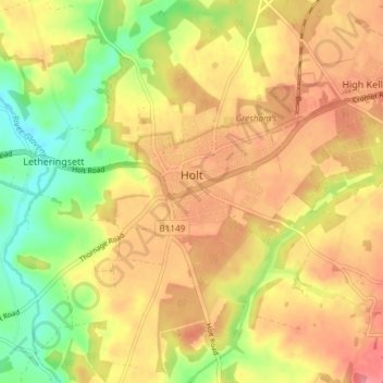
Name: Holt topographic map, elevation, terrain.

Location: Holt, North Norfolk, Norfolk, England, United Kingdom (52.88191 1.05621 52.92514 1.13055)

Average elevation: 171 ft

Minimum elevation: 26 ft

Maximum elevation: 272 ft

Other topographic maps

Click on a map to view its topography, its elevation and its terrain.

Hempstead

United Kingdom > England > Norfolk > North Norfolk

Average elevation: 223 ft

Gear up for your next adventure:

🚑Emergency Bivvies - Heat-reflective sleeping bags for survival situations
🪓Survival Multi‑Tool - Versatile tool for camp and trail tasks
🏔️Mountain Trail Maps - High‑detail maps for popular peaks
🔦LED Headlamp - Bright and durable LED headlamp for night navigation
🚪Portable Camp Chair - Foldable chair for comfort at camp

As an Amazon Associate, this site earns from qualifying purchases at no extra cost to you.