Geolocate

Halsey topographic map

Click on the map to display elevation.

About this map

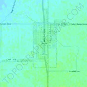
Name: Halsey topographic map, elevation, terrain.

Location: Halsey, Linn County, Oregon, United States (44.37553 -123.12146 44.39033 -123.10253)

Average elevation: 282 ft

Minimum elevation: 269 ft

Maximum elevation: 295 ft

Linn County trails, hiking, mountain biking, running and outdoor activities

Other topographic maps

Click on a map to view its topography, its elevation and its terrain.

Tamolitch Falls

United States > Oregon > Linn County

Average elevation: 2,864 ft

Clear Lake

United States > Oregon > Linn County

Average elevation: 3,291 ft

Cascadia

United States > Oregon > Linn County

Average elevation: 1,362 ft

Gear up for your next adventure:

🛠️Outdoor Gear Repair Kit - Essential tools to fix gear on the trail
🎒Outdoor Daypacks - Lightweight backpacks designed for carrying maps and essential gear
🥄Camping Utensil Set - Lightweight utensils for outdoor meals
📷Action Cameras - Rugged cameras to document your journeys across rugged terrain
🥾Women's Hiking Boots - Top-rated trail boots with ankle support and superior grip

As an Amazon Associate, this site earns from qualifying purchases at no extra cost to you.