Geolocate

Owatonna topographic map

Click on the map to display elevation.

About this map

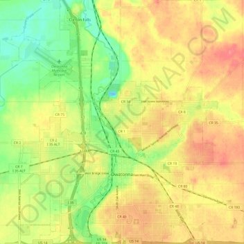
Name: Owatonna topographic map, elevation, terrain.

Location: Owatonna, Steele County, Minnesota, 55060, United States (44.05932 -93.28374 44.14574 -93.17906)

Average elevation: 1,184 ft

Minimum elevation: 1,063 ft

Maximum elevation: 1,286 ft

Steele County trails, hiking, mountain biking, running and outdoor activities

Gear up for your next adventure:

🧦Merino Wool Socks - Moisture-wicking, blister-preventing socks for long treks
🪶Camp Gear Gift Set - Perfect gift bundle for outdoor fans
🧭Orienteering Set - Complete compass and map reading kit
🛡️Bear Spray Outdoor - Protection in bear country hikes
🥩Freeze-Dried Meals - Nutritious and lightweight food for remote expeditions

As an Amazon Associate, this site earns from qualifying purchases at no extra cost to you.