Geolocate

Point Loma topographic map

Click on the map to display elevation.

About this map

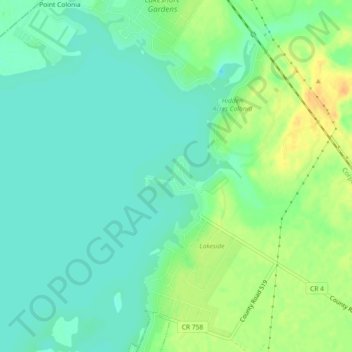
Name: Point Loma topographic map, elevation, terrain.

Location: Point Loma, San Patricio County, Texas, 78368, USA (28.09140 -97.88333 28.13140 -97.84333)

Average elevation: 112 ft

Minimum elevation: 72 ft

Maximum elevation: 174 ft

Gear up for your next adventure:

🪶Camp Gear Gift Set - Perfect gift bundle for outdoor fans
🔭Telescopic Hiking Pole - Adjustable pole for hiking stability
📦Gear Storage Bags - Organize and protect outdoor equipment
🛰️Handheld GPS Units - Professional satellite navigators for precise backcountry mapping
💧Water Filtration Bottles - Safely drink from streams and lakes while exploring

As an Amazon Associate, this site earns from qualifying purchases at no extra cost to you.