Geolocate

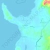
Kapito topographic map

Click on the map to display elevation.

About this map

Name: Kapito topographic map, elevation, terrain.

Location: Kapito, Lian, Batangas, Calabarzon, 4216, Philippines (13.99858 120.65380 14.03625 120.68818)

Average elevation: 174 ft

Minimum elevation: 23 ft

Maximum elevation: 830 ft

Other topographic maps

Click on a map to view its topography, its elevation and its terrain.
Binubusan

Philippines > Batangas > Lian

Average elevation: 157 ft

Luyahan

Philippines > Batangas > Lian

Average elevation: 49 ft

Puting Kahoy

Philippines > Batangas > Lian

Average elevation: 190 ft

Lumaniag

Philippines > Batangas > Lian

Average elevation: 121 ft

Palico River

Philippines > Batangas > Lian

Average elevation: 39 ft

Palico River

Philippines > Batangas > Lian

Average elevation: 39 ft

Gear up for your next adventure:

🪑Portable Camp Table - Compact table for campsite meals
👓Polarized Sunglasses - Outdoor sunglasses for glare reduction
🧷Carabiner Set - Durable clips for gear attachment
😴Insulated Sleeping Pads - Compact and warm pads for high-elevation camping
🪄Magnetic Compass - Accurate compass for navigation

As an Amazon Associate, this site earns from qualifying purchases at no extra cost to you.