Geolocate

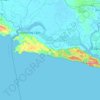
Limbangan topographic map

Click on the map to display elevation.

About this map

Name: Limbangan topographic map, elevation, terrain.

Location: Limbangan, Cilacap, Central Java, Indonesia (-7.32268 108.69205 -7.28268 108.73205)

Average elevation: 236 ft

Minimum elevation: 36 ft

Maximum elevation: 902 ft

Other topographic maps

Click on a map to view its topography, its elevation and its terrain.
Dusun Sukaharja

Indonesia > Central Java > Cilacap > Desa Hanum > Hanum

Average elevation: 1,503 ft

Gear up for your next adventure:

🗺️Topographic Maps - Detailed topo maps for hiking, exploring and outdoor navigation
🧤Tactile Hiking Gloves - Keep hands warm while operating GPS and smartphone screens
🪶Paracord Bracelet - Survival bracelet with built‑in tools
🛠️Outdoor Gear Repair Kit - Essential tools to fix gear on the trail
📱Heavy-Duty Phone Cases - Drop-proof and waterproof protection for outdoor navigation

As an Amazon Associate, this site earns from qualifying purchases at no extra cost to you.