Geolocate

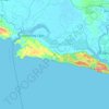
Limbangan topographic map

Click on the map to display elevation.

About this map

Name: Limbangan topographic map, elevation, terrain.

Location: Limbangan, Cilacap, Central Java, Indonesia (-7.32268 108.69205 -7.28268 108.73205)

Average elevation: 236 ft

Minimum elevation: 36 ft

Maximum elevation: 902 ft

Other topographic maps

Click on a map to view its topography, its elevation and its terrain.
Dusun Sukaharja

Indonesia > Central Java > Cilacap > Desa Hanum > Hanum

Average elevation: 1,503 ft

Gear up for your next adventure:

🔦Compact Flashlight - Reliable flashlight for emergencies
🛰️Handheld GPS Units - Professional satellite navigators for precise backcountry mapping
❄️Traction Cleats - Prevent slips on icy trails during winter hikes
🥩Freeze-Dried Meals - Nutritious and lightweight food for remote expeditions
🧭Map Reading Tools - Tools and kits for map navigation

As an Amazon Associate, this site earns from qualifying purchases at no extra cost to you.