Geolocate

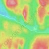
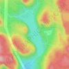
Labrieville topographic map

Click on the map to display elevation.

About this map

Name: Labrieville topographic map, elevation, terrain.

Location: Labrieville, Lac-au-Brochet, La Haute-Côte-Nord, Côte-Nord, Québec, Canada (49.28709 -69.56471 49.30709 -69.54471)

Average elevation: 863 ft

Minimum elevation: 436 ft

Maximum elevation: 1,785 ft

Other topographic maps

Click on a map to view its topography, its elevation and its terrain.
Lac Lacroix

Canada > Québec > La Haute-Côte-Nord > Lac-au-Brochet

Average elevation: 1,286 ft

Lac Gorgotton

Canada > Québec > La Haute-Côte-Nord > Lac-au-Brochet

Average elevation: 1,772 ft

Lac Charley

Canada > Québec > La Haute-Côte-Nord > Lac-au-Brochet

Average elevation: 1,444 ft

Lac Doré

Canada > Québec > La Haute-Côte-Nord > Lac-au-Brochet

Average elevation: 1,919 ft

Lac Gendron

Canada > Québec > La Haute-Côte-Nord > Lac-au-Brochet

Average elevation: 1,535 ft

Lac Gerry

Canada > Québec > La Haute-Côte-Nord > Lac-au-Brochet

Average elevation: 659 ft

Lac William

Canada > Québec > La Haute-Côte-Nord > Lac-au-Brochet

Average elevation: 1,138 ft

Lac Kinney

Canada > Québec > La Haute-Côte-Nord > Lac-au-Brochet

Average elevation: 1,119 ft

Lac Adèle

Canada > Québec > La Haute-Côte-Nord > Lac-au-Brochet

Average elevation: 640 ft

Lac Devine

Canada > Québec > La Haute-Côte-Nord > Lac-au-Brochet

Average elevation: 801 ft

Gear up for your next adventure:

🧦Merino Wool Socks - Moisture-wicking, blister-preventing socks for long treks
🥩Freeze-Dried Meals - Nutritious and lightweight food for remote expeditions
🧣Merino Neck Gaiters - Multi-functional headwear for wind and sun protection
🪵Folding Camp Saw - Compact saw for wood and campsite work
🛠️Outdoor Gear Repair Kit - Essential tools to fix gear on the trail

As an Amazon Associate, this site earns from qualifying purchases at no extra cost to you.