Geolocate

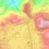
Alno topographic map

Click on the map to display elevation.

About this map

Name: Alno topographic map, elevation, terrain.

Location: Alno, La Trinidad, Benguet, Cordillera Administrative Region, 2601, Philippines (16.46635 120.57491 16.50635 120.61491)

Average elevation: 3,323 ft

Minimum elevation: 1,854 ft

Maximum elevation: 4,639 ft

Other topographic maps

Click on a map to view its topography, its elevation and its terrain.
Balili River

Philippines > Benguet > La Trinidad > Cruz

Average elevation: 3,924 ft

Bolo Creek

Philippines > Benguet > La Trinidad > Cabanao

Average elevation: 4,308 ft

Bolo Creek

Philippines > Benguet > La Trinidad > Cruz > Central Buyagan

Average elevation: 4,334 ft

Gear up for your next adventure:

🪑Ultralight Camp Chairs - Portable seating for resting after a long day of mapping
🔭Stargazing Telescopes - Perfect for camping in low-light pollution areas shown on maps
🥾Hiking Shoes - Durable and comfortable shoes for trail hiking
🗃️Trail First Aid Kit - Essential kit for outdoor injuries and emergencies
🧣Hiking Neck Gaiter - Multi‑use neck protection for outdoor weather

As an Amazon Associate, this site earns from qualifying purchases at no extra cost to you.