Geolocate

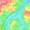
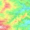
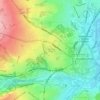
Lane topographic map

Click on the map to display elevation.

About this map

Name: Lane topographic map, elevation, terrain.

Location: Lane, Kirklees, West Yorkshire, England, HD9 2QF, United Kingdom (53.52713 -1.86592 53.56713 -1.82592)

Average elevation: 1,227 ft

Minimum elevation: 574 ft

Maximum elevation: 1,893 ft

Other topographic maps

Click on a map to view its topography, its elevation and its terrain.
Wessenden Head Reservoir

United Kingdom > England > Kirklees

Average elevation: 1,417 ft

Holmfirth Branch

United Kingdom > England > Kirklees > Brockholes

Average elevation: 607 ft

Meltham

United Kingdom > England > Kirklees

Average elevation: 912 ft

Mirfield

United Kingdom > England > Kirklees > Lower Hopton

Average elevation: 318 ft

Denby Dale

United Kingdom > England > Kirklees > Scissett

Average elevation: 551 ft

Kirkburton

United Kingdom > England > Kirklees

Average elevation: 486 ft

Holme Valley

United Kingdom > England > Kirklees > Holmfirth

Average elevation: 951 ft

Greenhead Park

United Kingdom > England > Kirklees > Huddersfield

Average elevation: 390 ft

Hey Wood

United Kingdom > England > Kirklees > Farnley Tyas

Average elevation: 610 ft

Crow Nest Park

United Kingdom > England > Kirklees > Dewsbury

Average elevation: 210 ft

Denby Dale

United Kingdom > England > Kirklees

Average elevation: 614 ft

Gear up for your next adventure:

🪄Magnetic Compass - Accurate compass for navigation
🪶Thermal Camp Blanket - Extra warmth for cold nights
🧯Emergency Survival Kit - All‑in‑one survival essentials for the backcountry
🧭Outdoor Navigation Book - Learn advanced navigation skills
🥾Men's Hiking Boots - Durable, waterproof footwear for rugged terrain and steep inclines

As an Amazon Associate, this site earns from qualifying purchases at no extra cost to you.