Geolocate

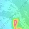
Pichidegua topographic map

Click on the map to display elevation.

About this map

Name: Pichidegua topographic map, elevation, terrain.

Location: Pichidegua, Provincia de Cachapoal, O'Higgins Region, 2980000, Chile (-34.48543 -71.47210 -34.23755 -71.18173)

Average elevation: 892 ft

Minimum elevation: 344 ft

Maximum elevation: 4,354 ft

Other topographic maps

Click on a map to view its topography, its elevation and its terrain.

La Chimba

Chile > O'Higgins Region > Provincia de Cachapoal > Rengo

Average elevation: 1,306 ft

Rosario

Chile > O'Higgins Region > Provincia de Cachapoal > Rengo

Average elevation: 1,155 ft

Gear up for your next adventure:

🛡️Insect Repellent - Protection against bugs during outdoor activities
👟Men's Trail Runners - Lightweight footwear for fast-paced exploration and light hiking
📦Gear Storage Bags - Organize and protect outdoor equipment
🏕️Family Camping Gear - Essentials for group camping trips
🌄Hiking Binoculars - Compact binoculars for scenic views and trail spotting

As an Amazon Associate, this site earns from qualifying purchases at no extra cost to you.