
Waycross topographic map
Click on the map to display elevation.
About this map
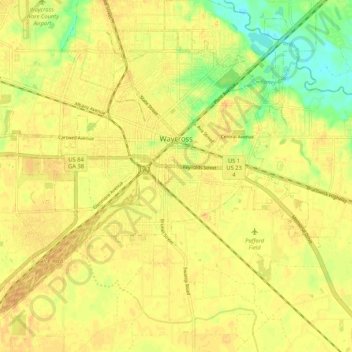
Name: Waycross topographic map, elevation, terrain.
Location: Waycross, Ware County, Georgia, 31501, United States (31.16190 -82.41569 31.24602 -82.31105)
Average elevation: 135 ft
Minimum elevation: 69 ft
Maximum elevation: 164 ft
Ware County trails, hiking, mountain biking, running and outdoor activities
Other topographic maps
Click on a map to view its topography, its elevation and its terrain.