

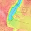
American Falls topographic map
Click on the map to display elevation.
About this map

Name: American Falls topographic map, elevation, terrain.
Average elevation: 558 ft
Minimum elevation: 318 ft
Maximum elevation: 686 ft
Other topographic maps
Click on a map to view its topography, its elevation and its terrain.

Whirlpool State Park
United States > New York > Niagara County > City of Niagara Falls
Average elevation: 541 ft
Niagara Falls
United States > New York > Niagara County > City of Niagara Falls
The peak flow over Horseshoe Falls was recorded at 6,370 cubic metres per second (225,000 cubic feet per second). The average annual flow rate is 2,400 m3/s (85,000 cu ft/s). Since the flow is a direct function of the Lake Erie water elevation, it typically peaks in late spring or early summer. During the…
Average elevation: 558 ft

Niagara Falls State Park
United States > New York > Niagara County > City of Niagara Falls
Average elevation: 558 ft
Niagara Falls
United States > New York > Niagara County > City of Niagara Falls
The peak flow over Horseshoe Falls was recorded at 6,370 cubic metres per second (225,000 cubic feet per second). The average annual flow rate is 2,400 m3/s (85,000 cu ft/s). Since the flow is a direct function of the Lake Erie water elevation, it typically peaks in late spring or early summer. During the…
Average elevation: 558 ft
Niagara Falls
United States > New York > Niagara County > City of Niagara Falls
The peak flow over Horseshoe Falls was recorded at 6,370 m3/s (225,000 cu ft/s). The average annual flow rate is 2,400 m3/s (85,000 cu ft/s). Since the flow is a direct function of the Lake Erie water elevation, it typically peaks in late spring or early summer. During the summer months, at least 2,800 m3/s…
Average elevation: 558 ft