Geolocate

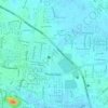
Way Gubak topographic map

Click on the map to display elevation.

About this map

Name: Way Gubak topographic map, elevation, terrain.

Location: Way Gubak, Bandar Lampung, Lampung, 35245, Indonesia (-5.45447 105.30104 -5.41447 105.34104)

Average elevation: 453 ft

Minimum elevation: 0 ft

Maximum elevation: 1,145 ft

Other topographic maps

Click on a map to view its topography, its elevation and its terrain.

Pulau Pasaran

Indonesia > Lampung > Bandar Lampung > Kangkung

Average elevation: 3 ft

PKOR Way Halim

Indonesia > Lampung > Bandar Lampung > Harapan Jaya

Average elevation: 335 ft

Gear up for your next adventure:

📖Nature Tracking Books - Learn to track wildlife and terrain
💧Water Purification System - Clean water on the trail with reliable purifiers
🗺️Topographic Maps - Detailed topo maps for hiking, exploring and outdoor navigation
🌡️Handheld Weather Meters - Measure wind, temp, and pressure for safe mountain travel
🛡️Bear Spray Outdoor - Protection in bear country hikes

As an Amazon Associate, this site earns from qualifying purchases at no extra cost to you.