Geolocate

Oakhurst topographic map

Click on the map to display elevation.

About this map
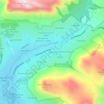
Name: Oakhurst topographic map, elevation, terrain.

Location: Oakhurst, Cape Town Ward 74, Hout Bay, City of Cape Town, Western Cape, 7872, South Africa (-34.04056 18.35476 -34.00056 18.39476)

Average elevation: 768 ft

Minimum elevation: 10 ft

Maximum elevation: 2,421 ft

Other topographic maps

Click on a map to view its topography, its elevation and its terrain.

Gear up for your next adventure:

⌚Solar GPS Watches - Advanced multisport watches with built-in topographic maps
🌡️Portable Weather Meter - Track weather conditions on the trail
⛑️Personal Locator Beacon - Safety beacon for emergencies
🗺️Topographic Maps - Detailed topo maps for hiking, exploring and outdoor navigation
🔌Solar Panel Charger - Charge gear sustainably outdoors

As an Amazon Associate, this site earns from qualifying purchases at no extra cost to you.