Geolocate

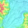
Maglajani topographic map

Click on the map to display elevation.

About this map

Name: Maglajani topographic map, elevation, terrain.

Location: Maglajani, Town of Laktaši, Republika Srpska, Bosnia and Herzegovina (44.92996 17.31789 44.96846 17.39310)

Average elevation: 374 ft

Minimum elevation: 348 ft

Maximum elevation: 407 ft

Other topographic maps

Click on a map to view its topography, its elevation and its terrain.

Gear up for your next adventure:

🦺Reflective Outdoor Gear - Safety gear for low‑light conditions
🧴Hand Sanitizer - Keep hands clean while hiking
🪵Folding Camp Saw - Compact saw for wood and campsite work
🔌USB Car Charger - Car charger for on‑the‑go power needs
🥾Hiking Shoes - Durable and comfortable shoes for trail hiking

As an Amazon Associate, this site earns from qualifying purchases at no extra cost to you.