
Make a donation
Gear up for your next adventure:
As an Amazon Associate, this site earns from qualifying purchases at no extra cost to you.
Murguía topographic map
Click on the map to display elevation.
Make a donation
Gear up for your next adventure:
As an Amazon Associate, this site earns from qualifying purchases at no extra cost to you.
About this map
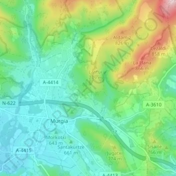
Name: Murguía topographic map, elevation, terrain.
Average elevation: 2,247 ft
Minimum elevation: 1,949 ft
Maximum elevation: 2,825 ft
Make a donation
Gear up for your next adventure:
As an Amazon Associate, this site earns from qualifying purchases at no extra cost to you.
Other topographic maps
Click on a map to view its topography, its elevation and its terrain.
Gorbeia
España > País Vasco > Estribaciones del Gorbea > Ceánuri
El monte Gorbea (en euskera: Gorbeia) es la cumbre más alta del macizo montañoso del mismo nombre, situado en los Montes Vascos, a caballo entre las provincias de Álava y Vizcaya, en el País Vasco (España). Tiene una altitud de 1482 metros sobre el nivel del mar y su cima está coronada desde 1899 por una…
Average elevation: 3,901 ft
Make a donation
Gear up for your next adventure:
As an Amazon Associate, this site earns from qualifying purchases at no extra cost to you.