Geolocate

County Armagh topographic map

Click on the map to display elevation.

About this map

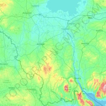
Name: County Armagh topographic map, elevation, terrain.

Location: County Armagh, Ulster, Northern Ireland, United Kingdom (54.03646 -6.87804 54.56754 -6.29086)

Average elevation: 322 ft

Minimum elevation: 0 ft

Maximum elevation: 1,867 ft

Other topographic maps

Click on a map to view its topography, its elevation and its terrain.

Attical

United Kingdom > Northern Ireland > County Down

Average elevation: 509 ft

Belfast

United Kingdom > Northern Ireland > County Antrim

Average elevation: 302 ft

Binian Lough

United Kingdom > Northern Ireland > County Down

Average elevation: 1,348 ft

Derry/Londonderry

United Kingdom > Northern Ireland > County Londonderry

Derry is characterised by its distinctively hilly topography. The River Foyle forms a deep valley as it flows through the city, making Derry a place of very steep streets and sudden, startling views. The original walled city of Londonderry lies on a hill on the west bank of the River Foyle. In the past, the…

Average elevation: 289 ft

Finnis

United Kingdom > Northern Ireland

Average elevation: 604 ft

Dromara

United Kingdom > Northern Ireland > County Down

Average elevation: 489 ft

Drumbo

United Kingdom > Northern Ireland > County Down

Average elevation: 308 ft

Clough

United Kingdom > Northern Ireland > County Down

Average elevation: 105 ft

Crossmaglen

United Kingdom > Northern Ireland

Average elevation: 404 ft

Carryduff

United Kingdom > Northern Ireland > County Down

Average elevation: 361 ft

Whitecross

United Kingdom > Northern Ireland

Average elevation: 417 ft

Armagh

United Kingdom > Northern Ireland > Armagh

Average elevation: 279 ft

Larne

United Kingdom > Northern Ireland > County Antrim > Larne

Average elevation: 177 ft

Glynn

United Kingdom > Northern Ireland > County Antrim > Glynn

Average elevation: 207 ft

Tempo

United Kingdom > Northern Ireland > County Fermanagh

Average elevation: 417 ft

Ahoghill

United Kingdom > Northern Ireland > County Antrim

Average elevation: 276 ft

Gear up for your next adventure:

👟Trail Running Shoes - Lightweight shoes for trail runners
🥾Men's Hiking Boots - Durable, waterproof footwear for rugged terrain and steep inclines
🧢Sun Protection Hats - Wide-brimmed and UPF-rated hats for high-altitude sun safety
⛑️Personal Locator Beacon - Safety beacon for emergencies
🥤Water Filter Bottle - All‑in‑one filter bottle for safe hydration

As an Amazon Associate, this site earns from qualifying purchases at no extra cost to you.