
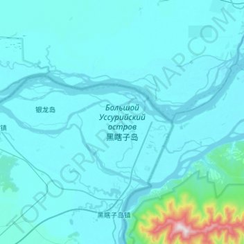
Bolshoy Ussuriysky Island topographic map
Interactive map
Click on the map to display elevation.
About this map
Name: Bolshoy Ussuriysky Island topographic map, elevation, terrain.
Average elevation: 207 ft
Minimum elevation: 95 ft
Maximum elevation: 1,634 ft
Other topographic maps
Click on a map to view its topography, its elevation and its terrain.
Бычиха
Russia > Khabarovsk Krai > Khabarovsky District > Бычиха
Бычиха, сельское поселение Село Бычиха, Khabarovsky District, Khabarovsk Krai, Far Eastern Federal District, Russia
Average elevation: 164 ft