
Thank you for supporting this site ❤️
Make a donation
Make a donation
Gear up for your next adventure:
As an Amazon Associate, this site earns from qualifying purchases at no extra cost to you.
Gniezno topographic map
Click on the map to display elevation.
Thank you for supporting this site ❤️
Make a donation
Make a donation
Gear up for your next adventure:
As an Amazon Associate, this site earns from qualifying purchases at no extra cost to you.
About this map
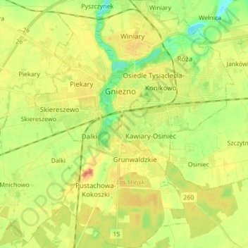
Name: Gniezno topographic map, elevation, terrain.
Location: Gniezno, Gniezno County, Greater Poland Voivodeship, Poland (52.48300 17.54774 52.56675 17.65894)
Average elevation: 390 ft
Minimum elevation: 308 ft
Maximum elevation: 472 ft
Thank you for supporting this site ❤️
Make a donation
Make a donation
Gear up for your next adventure:
As an Amazon Associate, this site earns from qualifying purchases at no extra cost to you.