Geolocate

Lapasan topographic map

Click on the map to display elevation.

About this map

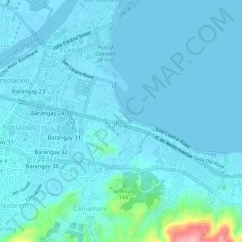
Name: Lapasan topographic map, elevation, terrain.

Location: Lapasan, Cagayan de Oro, Northern Mindanao, 9000, Philippines (8.46328 124.64490 8.50328 124.68490)

Average elevation: 43 ft

Minimum elevation: -13 ft

Maximum elevation: 476 ft

Other topographic maps

Click on a map to view its topography, its elevation and its terrain.

Calaanan Creek

Philippines > Cagayan de Oro

Average elevation: 230 ft

Gear up for your next adventure:

🧭Compass with Lanyard - Easy‑carry compass for navigation
🗻Climbing Gear Basics - Essential gear for beginner climbers
🍳Camping Cook Set - Complete cookware for outdoor meals
🚑Emergency Bivvies - Heat-reflective sleeping bags for survival situations
🧦Hiking Socks - Comfortable socks to prevent blisters on long hikes

As an Amazon Associate, this site earns from qualifying purchases at no extra cost to you.