
Thank you for supporting this site ❤️
Make a donation
Make a donation
Gear up for your next adventure:
As an Amazon Associate, this site earns from qualifying purchases at no extra cost to you.
Kalapani topographic map
Click on the map to display elevation.
Thank you for supporting this site ❤️
Make a donation
Make a donation
Gear up for your next adventure:
As an Amazon Associate, this site earns from qualifying purchases at no extra cost to you.
About this map
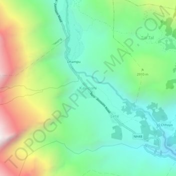
Name: Kalapani topographic map, elevation, terrain.
Location: Kalapani, Lete, Thasang, Mustang, Gandaki Pradesh, Nepal (28.62219 83.57868 28.66219 83.61868)
Average elevation: 9,222 ft
Minimum elevation: 7,516 ft
Maximum elevation: 12,746 ft
Thank you for supporting this site ❤️
Make a donation
Make a donation
Gear up for your next adventure:
As an Amazon Associate, this site earns from qualifying purchases at no extra cost to you.