
Anticosti Island topographic map
Interactive map
Click on the map to display elevation.
About this map
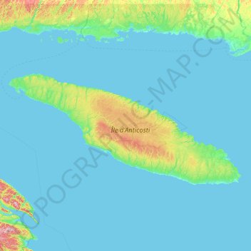
Name: Anticosti Island topographic map, elevation, terrain.
Location: Anticosti Island, Minganie, Côte-Nord, Quebec, Canada (48.52877 -64.08899 50.52877 -62.08899)
Average elevation: 121 ft
Minimum elevation: -7 ft
Maximum elevation: 1,821 ft
Other topographic maps
Click on a map to view its topography, its elevation and its terrain.
Rivière aux Rats
Canada > Quebec > Anticosti Island
Rivière aux Rats, Anticosti Island, Minganie, Côte-Nord, Quebec, Canada
Average elevation: 371 ft