Geolocate

Nasi topographic map

Click on the map to display elevation.

About this map

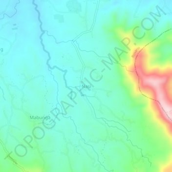
Name: Nasi topographic map, elevation, terrain.

Location: Nasi, Rosario, Batangas, Calabarzon, Philippines (13.75642 121.29034 13.79642 121.33034)

Average elevation: 512 ft

Minimum elevation: 256 ft

Maximum elevation: 1,414 ft

Gear up for your next adventure:

💧Water Filtration Bottles - Safely drink from streams and lakes while exploring
🪶Camp Gear Gift Set - Perfect gift bundle for outdoor fans
🏫Relief Map Kits - Hands-on tools for teaching landforms and elevation
🥾Women's Hiking Boots - Top-rated trail boots with ankle support and superior grip
🪶Survival Guide Book - Expert advice for emergency preparedness

As an Amazon Associate, this site earns from qualifying purchases at no extra cost to you.