
Thank you for supporting this site ❤️
Make a donation
Make a donation
Gear up for your next adventure:
As an Amazon Associate, this site earns from qualifying purchases at no extra cost to you.
Sammouniyeh topographic map
Click on the map to display elevation.
Thank you for supporting this site ❤️
Make a donation
Make a donation
Gear up for your next adventure:
As an Amazon Associate, this site earns from qualifying purchases at no extra cost to you.
About this map
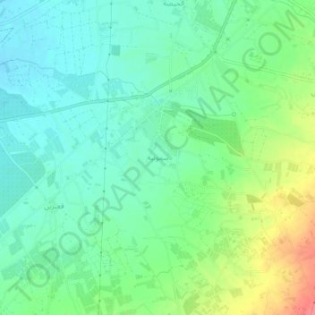
Name: Sammouniyeh topographic map, elevation, terrain.
Location: Sammouniyeh, Akkar District, Akkar Governorate, 00961, Lebanon (34.55400 36.02964 34.59400 36.06964)
Average elevation: 112 ft
Minimum elevation: 39 ft
Maximum elevation: 266 ft
Thank you for supporting this site ❤️
Make a donation
Make a donation
Gear up for your next adventure:
As an Amazon Associate, this site earns from qualifying purchases at no extra cost to you.