
Thank you for supporting this site ❤️
Make a donation
Make a donation
Gear up for your next adventure:
As an Amazon Associate, this site earns from qualifying purchases at no extra cost to you.
Andria topographic map
Click on the map to display elevation.
Thank you for supporting this site ❤️
Make a donation
Make a donation
Gear up for your next adventure:
As an Amazon Associate, this site earns from qualifying purchases at no extra cost to you.
About this map
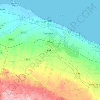
Name: Andria topographic map, elevation, terrain.
Location: Andria, Barletta-Andria-Trani, Apulia, 76123, Italy (41.06765 16.13543 41.38765 16.45543)
Average elevation: 499 ft
Minimum elevation: -10 ft
Maximum elevation: 2,011 ft
Thank you for supporting this site ❤️
Make a donation
Make a donation
Gear up for your next adventure:
As an Amazon Associate, this site earns from qualifying purchases at no extra cost to you.