Geolocate

Krakow topographic map

Click on the map to display elevation.

About this map

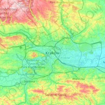
Name: Krakow topographic map, elevation, terrain.

Location: Krakow, Lesser Poland Voivodeship, 31-013, Poland (49.90195 19.77686 50.22195 20.09686)

Average elevation: 896 ft

Minimum elevation: 620 ft

Maximum elevation: 1,617 ft

Gear up for your next adventure:

📱Heavy-Duty Phone Cases - Drop-proof and waterproof protection for outdoor navigation
🚁Photography Drones - Capture stunning aerial views of landforms and topography
🛰️Handheld GPS Units - Professional satellite navigators for precise backcountry mapping
☀️Outdoor Sunscreen - High protection sunscreen for outdoor activities
🛠️Backpacking Tool Kit - Essential toolkit for outdoor repairs

As an Amazon Associate, this site earns from qualifying purchases at no extra cost to you.